 Unknown Artist
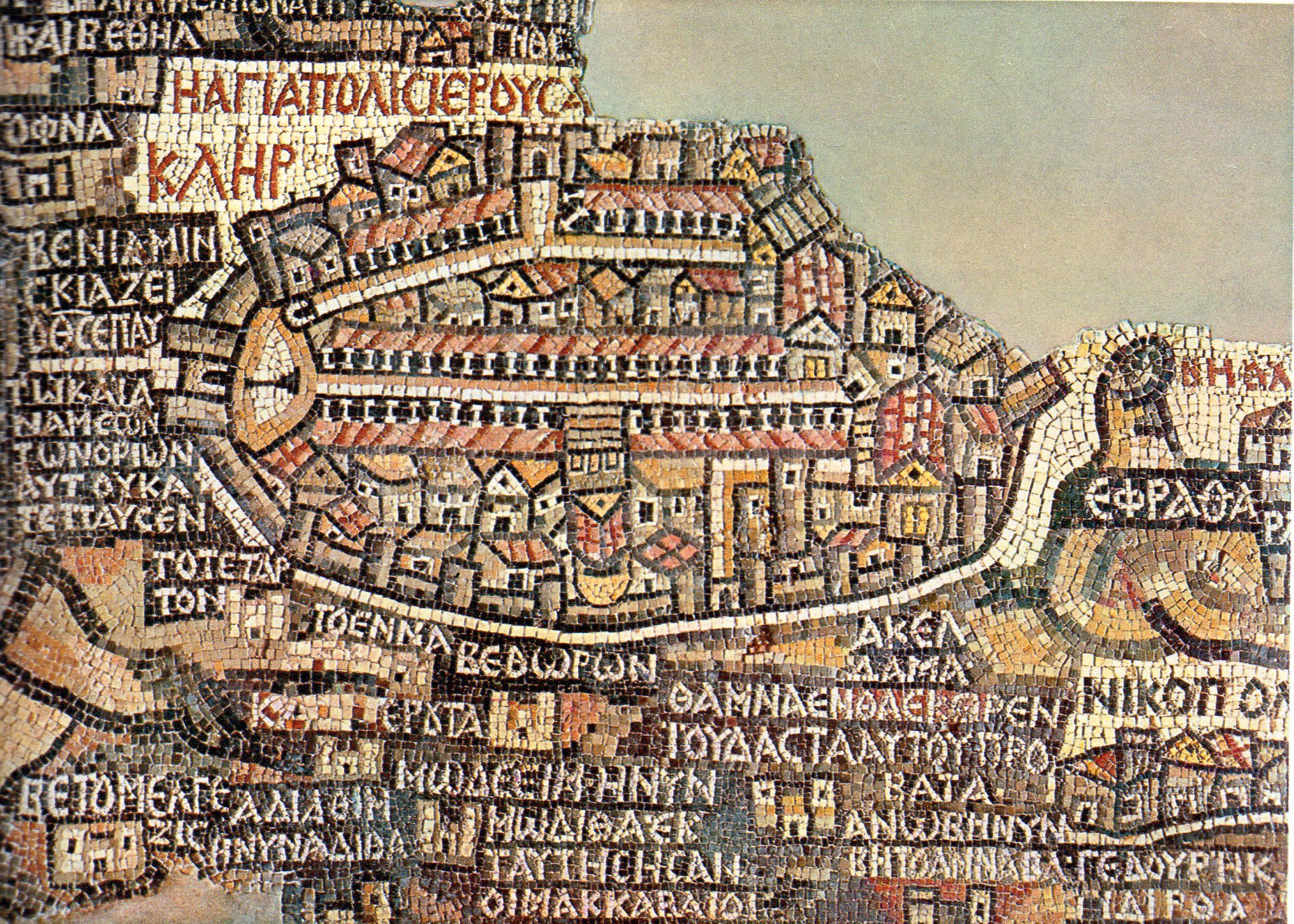
Antique mosaics are impressive because they can be very detailed. This one is a 6th century map. It covers 16 meters of the floor of St. George's Church in the city of Madaba (Jordan).
This map shows the late antique knowledge of Middle Eastern geography with a specific religious point of view. Indeed, the mosaic represents the biblical land from Egypt to Lebanon.
We can read a lot of city names, written in Greek, as well as rivers, mountains, and tribe names. It can be seen both as a road map a pilgrimage map.
In today's image we see the very center of the map: the holy city of Jerusalem. The perspective is not correct but has enough architectural details to be recognized. The colonnade and buildings refer to real places of that time, like the New Church of the Theotokos, erected by the Byzantine Emperor Justinian in 543. All this information allows us to date the map.
A mosaic is an artwork done with little pieces of stone or glass. Natural colors are used to create 3D effects and volume. Between the 3rd and the 6th centuries, mosaics were made in churches and houses all around the Mediterranean Sea and could display Christian, pagan, geometrical, or natural patterns. Madaba had its own famous mosaic workshop, and we recognize the Madaba School style in various places of the region.
- Coraline Méric
P.S. If you love mosaics as we do, see the fragment of a floor mosaic with a personification of Ktisis here!